Note: Position are open only to Dutch candidates (mother tongue) when description is in Dutch
1. Overlandflow, plasvorming en vochtgehalten in klei op veengebieden (binnen de projecten Spaarwater II en Spaarwater Flevoland)
Overlandflow en plassen op het maaiveld komen veelvuldig voor. Ook op percelen met buisdrainage, waar klei op veen aanwezig is. De natte omstandigheden beïnvloeden de draagkracht van het veld, de af- en inspoeling van meststoffen, en gewasgroei. Het aanvullend bestuderen van deze processen is daarom ontzettend relevant voor de Spaarwater-projecten, inclusief Spaarwater Flevoland (Nooordoospolder). Tijdens deze stage zou de student:
Literatuuronderzoek doen naar de genoemde processen
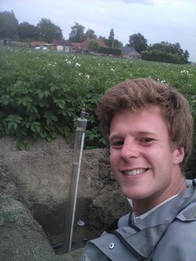
Het vochtgehalte en de pF/onderdruk meten met een quick draw tensiometer op meerdere dieptes en op meerdere plekken, om meer inzicht te krijgen in de variatie in de ruimte en de tijd
Overlandflowmetingen uitvoeren, om de hoeveelheid oppervlakkige afvoer te bepalen
De continumetingen/loggergegevens vergelijken met de handmatig uitgevoerde metingen.
2. Carrying capacity of rangelands in Arid and Semi-Arid Lands (within the Aqua4Darfur Project, Sudan)
One of the main drivers of poverty in the Darfur region is water availability. Climate variability means that rainfall is unreliable. During dry periods little water is available for people, livestock, crops, and the quantity and quality of pastures is low. Competition over water and pastures is a key cause of conflict. Increasing pressure on natural resources has led to over-use and environmental degradation. There is limited knowledge about the definition and calculation of the carrying capacity of the rangelands in this region. Such assessment should take into consideration the migrating livestock herds. Altogether, such insight can support decision-making on water infrastructure development, and water management practices. The research would consist of the following steps (indicative):
Assessment of the livestock rangeland demand and carrying capacity of rangelands;
Establishment of the main livestock migration routes;
Assessment of the relation between rainfall and grazing patterns;
Mapping grazing practices and how they do or do not keep grazing grounds healthy and vital;
Quantification of the effects (e.g. over-grazing) of constructed water points on residence time of livestock herds; and
Establishing a first approach for quantification of the carrying capacity of rangelands, including overview of the boundary conditions as well as its limitations.
For this position it is important to have knowledge of biology, animal sciences, and land and water management. Experience with working with GIS and/or remote sensing is required. Having (work) experience in an international development setting is a pre.
3. Geodetics – Global positioning systems
In collaboration with partners Acacia Water is developing low-cost sensors to monitor groundwater and soil water quantity and quality. In The Netherlands, these sensors are mostly used for support to precision farming, while abroad they can be used to start collecting basic information in data scarce areas. Acacia Water is looking for a student geodetics that would like to support the development of these sensors. During the thesis/ internship you would be involved in finalizing the development and testing of the sensors, and you would be invited to think along about next steps, future developments, etc.
For this position you need to study geodetics or similar at a Technical University/Institute, have knowledge on sensor-development (including the hardware) and experience with pre- and postprocessing of large datasets.
Please contact Mieke Hulshof (mieke.hulshof@acaciawater.com) for more information about internships and thesis positions.


