News & Projects
2 news items fullfill your search criteria
Environmental risk assessment & ecosystem mapping in South Sudan
25-05-2018
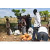
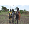
The Kinaite River flows northward from the Imatong Mountains eventually dispersing into the wetlands of Badingilo National Park. The Kinaite catchment is an area with a high biodiversity. Today, many locals are heavily dependent on the wetland and forest reserve for timber, firewood, charcoal, bush…
Environmental Risk Assessment & Ecosystem mapping in South Sudan
25-04-2017
The Kinneti River flows northward from the Imatong Mountains eventually dispersing into the wetlands of Badingilo National Park. The Kinneti catchment is an area with a high biodiversity, a large part of the mountain range is part of the Imatong Central Forest Reserve (Mt Kinyeti 3170 masl). Today,…
News & Projects |
Tagcloud
- acaciawater
- disaster risk reduction
- ecosystem degradation
- ecosystem mapping
- ecosystem risk assessment
- ecosystems
- groundwater
- new
Search for news
you searched for: south sudan
Van Hogendorpplein 4 |
|---|
Location
Service
Newsletter
Search
IWRM & Catchment management | Strategical assessments | Urban planning | Innovative techniques | System specific approach
Copyright 2025 - Acacia Water UK


