Groundwater mapping for climate resilient WASH in Ethiopia
Launch of the online GW4E project viewer!
On October 6th, the project team of Groundwater Mapping 4 Climate Resilient WASH in arid and semi-arid areas of Ethiopia (GW4E) held the closure activities of the project with two online sessions: ‘Use and applications of the online webtool and the Dissemination Workshop of the EU RESET funded UNICEF project GW4E.
The team and the implementing agency UNICEF were very satisfied with the results achieved and thanked all participants of both sessions for the nice interaction and relevant questions.
UNICEF Ethiopia, through the EU-RESET II program, has tasked Acacia Water and a pool of local experts to conduct a groundwater mapping study to identify groundwater abstraction suitable locations in 5 semi-arid regions of Ethiopia. The project encompasses 41 water scarce woredas known to have complex hydrogeology. In total, 39 woredas were prioritized and grouped in 8 clusters, respectively Wag Himra, Afar, Siti, Liben, Bale, Borena, Wolayta and South Omo.
The projects main deliverables were:
- Woreda water points inventory and water quality survey
- Harmonization and updated geological maps (1:50,000)
- Woreda groundwater suitability maps
- Hydrogeological conceptual models and cross sections
- Hydrogeological operational maps (1:50,000)
- Drilling site maps (1:10,000)
All project deliverables are to be found in the Dissemination Tool, with a Map Viewer section and a Reports and Maps section: https://gw4e.acaciadata.com/ (https://gw4e.acaciadata.com/). They are all made available for download, including some of the GIS-based data.
The Groundwater Mapping for Climate Resilient WASH in Ethiopia partnership (GW4E) has
been established and successfully carried out by Acacia Water in cooperation with Dr. Seifu
Kebede, Mr. Abebe Ketema, Acquacon Engineering, Ministry of Water, Irrigation and Energy
- MOWIE, EU-JRC and the full leadership and support of UNICEF Ethiopia. The project has
been funded by the EU-RESET II program and has been carried out between June 2018 and
October 2020.
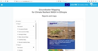 WEBportal
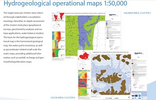 hydrogeo maps
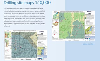 drilling maps