Hydrogeological mapping for Climate Resilient WASH in Ethiopia
Groundwater suitability maps and identification of drilling target sites
Acacia Water in collaboration with a local team of experts has been tasked by UNICEF Ethiopia /EU RESET II program to conduct a groundwater study to make groundwater suitability maps and to identify drilling target sites for 16 boreholes in 5 regions of the RESET II program. By conducting this study, the project will greatly enhance the success rate for 16 new wells and their long-term sustainability.
The RESET program areas encompass 41 water scarce districts of Ethiopia known to have complex hydrogeology. These districts (woredas) are grouped into 8 clusters spread over 5 regions. The complexity of the hydrogeology is manifested by low and indirect groundwater recharge, rugged topography, too low yielding shallow groundwaters, high salinity and very low past drilling success rates. In addition, the widely dispersed communities and pastoral or semi pastoral livelihoods further complicated high WASH coverage and access in these areas.
Taking into consideration the complex hydrogeology, Acacia Water and its local partners have employed and improved the UNICEF developed groundwater exploration approach to achieve the objectives of the project. The method involves a GIS based overlay analysis and conventional and integrated hydrogeological mapping. The employment of the two methods comes in two phases. Phase 1 aims to conduct the groundwater suitability mapping using the UNICEF approach of overlay analysis. Detailed hydrogeological mapping is the aim of the phase 2 study under this project.
The overlay analysis involves GIS computation of groundwater suitability by factoring various indicators for groundwater suitability and their weighting factors. The five indicator parameters that were chosen are: Permeability, Lithology, Slope, Recharge and Land use/Landcover. All in all, the overlay analysis results match the ground conditions observed from previous studies. In addition to the suitability maps, water demand and socio-economic maps were created based on census data and other reports. These maps showed administrative boundaries, population, population densities, villages, health centres, schools, roads and electric power lines.
The geological, groundwater suitability, water demand and socio-economic maps formed the basis for the zonal consultation meetings in the RESET II cluster areas. In these meetings, stakeholders like NGO’s, zonal and regional water bureaus and district representatives participated. They selected, through an iterative process, the priority communities for WASH interventions. The groundwater suitability maps and all other maps serve future drilling projects in the RESET II cluster areas and are disseminated to all stakeholders through a webservice.
For more information you can contact our colleague Daniela Benedicto van Dalen (mailto:Daniela.Benedicto@acaciawater.com).
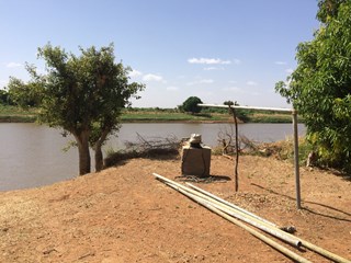 Unfinisched Borehole