Acacia Water’s potential map enlightens water resources development options in Nakuru, Kenya!
Providing technical support to the WaterWorX partnership
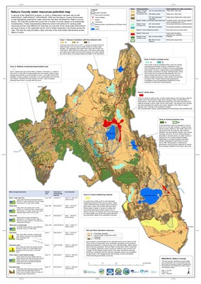
Acacia Water can quickly assess and show the water resources development potential of a dryland, water scarce area. Many countries are dealing with issues for provision of clean and safe water. Population growth, land use changes and climate change are widespread and make clean and safe water provision a major challenge across the globe. This also applies to Nakuru County in Kenya, where population growth is rapid and the negative effects of landcover changes and climate change are keenly felt. Moreover, Nakuru County faces challenges with high fluoride levels in their groundwater. As most of the domestic water is produced through boreholes, this has become a major health concern. Additionally, depletion of groundwater is becoming a concern as well.
Not just drilling another borehole
In the face of all these different challenges, improving water security throughout the year, now and in the future, becomes a complex issue. While traditionally, just drilling another borehole might often have been an adequate solution, a straightforward solution like that just does not cut it anymore. In answer to such cases, Acacia Water has developed the Landscape Approach. By looking for the natural and biophysical potential of an area, rainwater can be harvested smarter while building resilience against challenges like land use and climate change.
Water harvesting interventions depend on the landscape characteristics
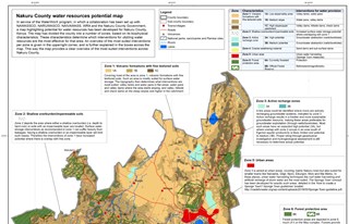
Following this Landscape Approach, the ‘Nakuru County Water Resources Potential map’ was developed by Acacia Water (see link below). In this map, Nakuru County is divided into specific zones, where for each specific zone a different set of suited land and water development interventions is given depending on the characteristics of the landscape. In this case, these interventions are mostly aimed at direct water provision and are suited especially at community and peri-urban level, while they are tailored to alleviate the specific challenges of the County.
Technical support for Strategic Development Plans
Having such a map provides a clear overview of which interventions are suitable where, with concise explanations and rough indications of cost and yield. With such an overview, water development officers and policy-makers are technically supported which sustainable development options suit best where. Thus, removing barriers to the development of a Strategic Development Plan while at the same time creating common understanding. If you know the water demand for specific locations in your area and combine them with the potential map, you immediately see the options! The next step is a rough design and cost estimation of the number and size of the optional interventions, whilst working on integrated water management.
WaterWorX
The ‘Nakuru County Water Resources Potential map’ has been produced in service of the WaterWorX program. WaterWorX is a public-private collaboration where local water utilities work together with Dutch water utilities to increase access to clean and safe water in developing countries across the globe. In Nakuru County, a collaboration has been set up between Vitens Evides International (VEI) (https://www.vei.nl/) and the three local water utilities (NAWASSCO (https://nakuruwater.co.ke/), NARUWASCO (https://www.naruwasco.co.ke/) and NAIVAWASS (https://www.naivashawater.co.ke/)), as well as with the Water Resources Authority (WRA) (https://wra.go.ke/) and the County Government of Nakuru (https://nakuru.go.ke/). As part of the WaterWorX partnership the partners are working towards developing ‘Climate Resilient water supply plans 2050’, containing a strategy to provide the whole of Nakuru County with clean and safe water while being climate resilient in 2050. For this process, Acacia Water provides technical support to the WaterWorX partnership.
For more information you can contact our colleagues Ruben van der Meulen (mailto:ruben.vandermeulen@acaciawater.com) or Stefan de Wildt (mailto:stefan.dewildt@acaciawater.com).
 zoom2
zoom2
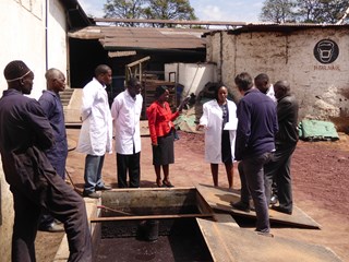 P1070821
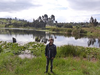 P1070881
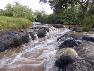 P1070892
 Water resources potential map Nakuru County 2019