Environmental Risk Assessment & Ecosystem mapping in South Sudan
New project in Kinneti Catchment for community resilience
The Kinneti River flows northward from the Imatong Mountains eventually dispersing into the wetlands of Badingilo National Park. The Kinneti catchment is an area with a high biodiversity, a large part of the mountain range is part of the Imatong Central Forest Reserve (Mt Kinyeti 3170 masl). Today, many locals are heavily dependent on the wetland and forest reserve for timber, firewood, charcoal, bush meat and arable land. Such activities provide an income and survival of people within the region but are not sustainable. The ecosystems in the area are degrading.
Over the last decade, the Kinneti Catchment has experienced droughts, inconsistent rainfall patterns and floods. Activities such as deforestation, hillside farming and agriculture in wetlands and has led to soil erosion and reduced water conservation in soils. The poor soils and erratic rainfall has led to significant reduction in crop yields over the years. This is affecting the food security for humans and animals and increasing the community’s competition for pasture and water.
Acacia Water is working together with Wetlands International Kenya in Kinneti Catchment, South Sudan, on the Protracted Crisis Horn of Africa (PCHA) Project. The ultimate aim of the project is community stability and resilience through strategic interventions for food security, water security and disaster risk reduction. Acacia Water is conducting ecosystem mapping combined with an environmental risk assessment in order to inform the stakeholders on the baseline situation for the project.
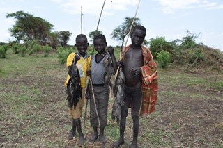 Fish caught_2
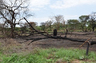 Vegetation clearing and burning
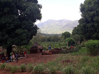 Village Landscape
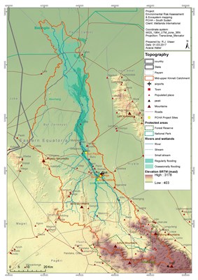 Topography